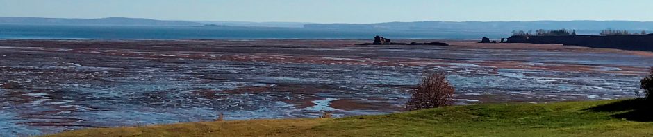
 Figure 1. Winter ice on the salt marshes of Minas Basin photographed from Wolfville, Nova Scotia, March 1, 2007. View to the North.
What is an estuary? An estuary is a bay with an open connection to the sea. Rivers flow into an estuary, mixing with sea water, resulting in a brackish water environment. All estuaries that we see today came into existence after the rapid sea level rise that marked the end of the last ice age ca. 12,000 years ago. If sea level stays stable long enough, estuaries eventually completely fill with sediment (pushing the shoreline seaward). There is ample evidence of filled estuarine sedimentary sequences in the geologic record and while they all share commonalities, they are also all unique and different from each other because the local conditions were different at their time of formation.
In our present-day world, estuaries are important habitats. Healthy estuaries are surrounded by tidal marshes, the extent of which depend on the estuary’s tide range. Tidal marshes generate lots of primary nutrients, mostly carbon (from marsh vegetation and dead critters), upon which feed fish larvae and other creatures all the way up the food chain. Estuaries are fertile places and therefore people like to live around them.
What I want to show you are some of the utterly amazing features of the estuary in my back yard: Minas Basin, an arm of the Bay of Fundy, boasting the highest tide range in the world, up to 18 meters between high and low tide. And despite being located at 45N, Minas Basin also experiences really serious winter ice conditions, which influence its sediment and nutrient balance. The estuary is bordered by soft shale and sandstone cliffs, which erode rapidly under the attack of tides and winter ice. The land surface is otherwise covered in thick, soft and easily erodible glacial deposits. The only other estuary in the whole world that compares somewhat with Minas Basin is Knik Arm, Alaska. So they are both pretty unique.
In early 2007, I collected some data for a sedimentary geology class I was teaching and we did an overflight with a small aircraft on what turned out to be the day of maximum ice extent in Minas Basin. It also turned out to be the day after the astronauts on the International Space Station took a picture of our part of the world. Two lucky coincidences:

Figure 2. The upper Bay of Fundy photographed by astronauts in the International Space Station on Feb 28, 2007 (image source here). Inset: Bay of Fundy and its tide ranges in meters. The red square indicates the coverage of the ISS image. The white streaks in Minas Basin are ice rafts, stringing along on the outgoing currents (the image was taken 3 hours after high tide). Click on image to increase size.

Figure 3. Ice rafts on the outgoing tide in Minas Basin, March 1, 2007, a day after the ISS image was taken. The headland in view is Cape Blomidon, the entry to Minas Basin is behind it. View to the NW. Photo taken from a small aircraft (that was a very cold flight!).
The Bay of Fundy itself almost never sees ice rafts, but its two extremities, Minas Basin and Cumberland Basin, generally see them every year. The reason is salinity. Minas Basin and Cumberland Basin are less saline than the Bay of Fundy itself because of the rivers flowing into them. Fresh water freezes at 0oC. Seawater, which has an average salinity of 35 ppm (parts per million), freezes at -2oC. That seems only a tiny difference but it makes for big differences in the field.
Let’s look at the system first:
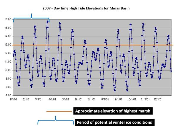
Figure 4. Predicted day-time high tide range in Minas Basin for the year 2007 (there are two high tides per 25 hours, but for visual clarity, only the day-time high tide is included here). Vertical scale is in meters: zero is mean sea level. The horizontal scale represents the days of the year, all 365 of them. Note that there is a difference of about 9 meters between the lowest and the highest high tides during the year! The orange line indicates the approximate elevation of the high supratidal marsh. The blue accolade indicates the period of potential winter ice conditions. The extreme high tides bulges during the first and second half of the year are the months with perigean spring tides.

Figure 5. Observed mean temperatures (lower bars, data source here) and predicted day time high tide range for Minas Basin, March 1 through 31, 2007. Vertical scale of top half is in meters, vertical scale of bottom half is in degrees C. The “Ice Window”, i.e. the period during which ice rafts were able to form, lasted from mid January through mid March that year, but the high tide flooded the marsh only for a few days in late January and February. By late March, when the tides flooded the marshes again, most ice rafts had melted significantly.
When winter ice begins to form, it first forms closest to the shore on the marshes and on the edges of the tidal creeks near the river mouths, where the salinity is lowest (for simplicity sake, I’m ignoring supercooling here). Once a smaller ice raft is formed, it grows – with more ice, but also with frozen mud and dead vegetation. As the incoming tide floods the channels, ice is nudged up the sides of the tidal channels until the water starts spilling onto the marsh. The tide chart (Figure 4). shows that the marsh is rarely completely flooded: less than 10% of all the high tides in a year flood the marshes completely and some of those happen in winter (blue bracket on Figure 4).
Theoretically, at every higher high tide, the ice rafts are floated up further to the marsh interior but this works only for a limited time because the rafts become very heavy: they may contain as much as to 35% sediment by weight, as a result of which they become frozen to the marsh surface and so get stranded on the tidal creek edges, as can be seen in figures 6 and 7 below.

Figure 6. March 1, ’07: Ice blocks (dirty-ish blobs) concentrated on the edges of the tidal creeks as seen from a small aircraft. Width of view ca 200 m.
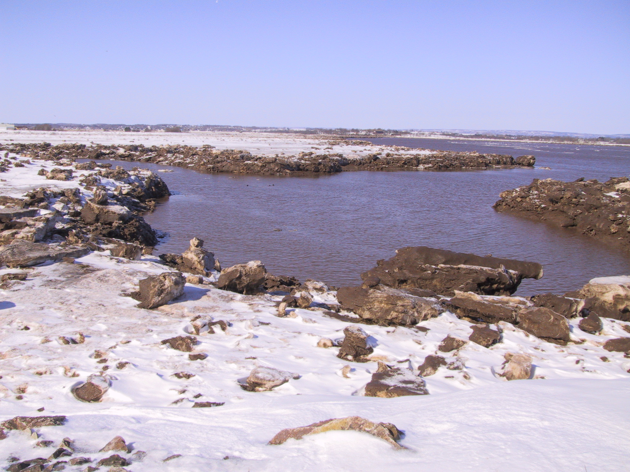

Figure 7. March 1, 2007. Left: ice blocks concentrated on the edges of the tidal creeks, same area as figure 6. Right: multigenerational ice raft incorporating sediment and dead vegetation.
Any ice that doesn’t freeze to the marsh surface, floats around on the tidal current and forms amazing patterns.

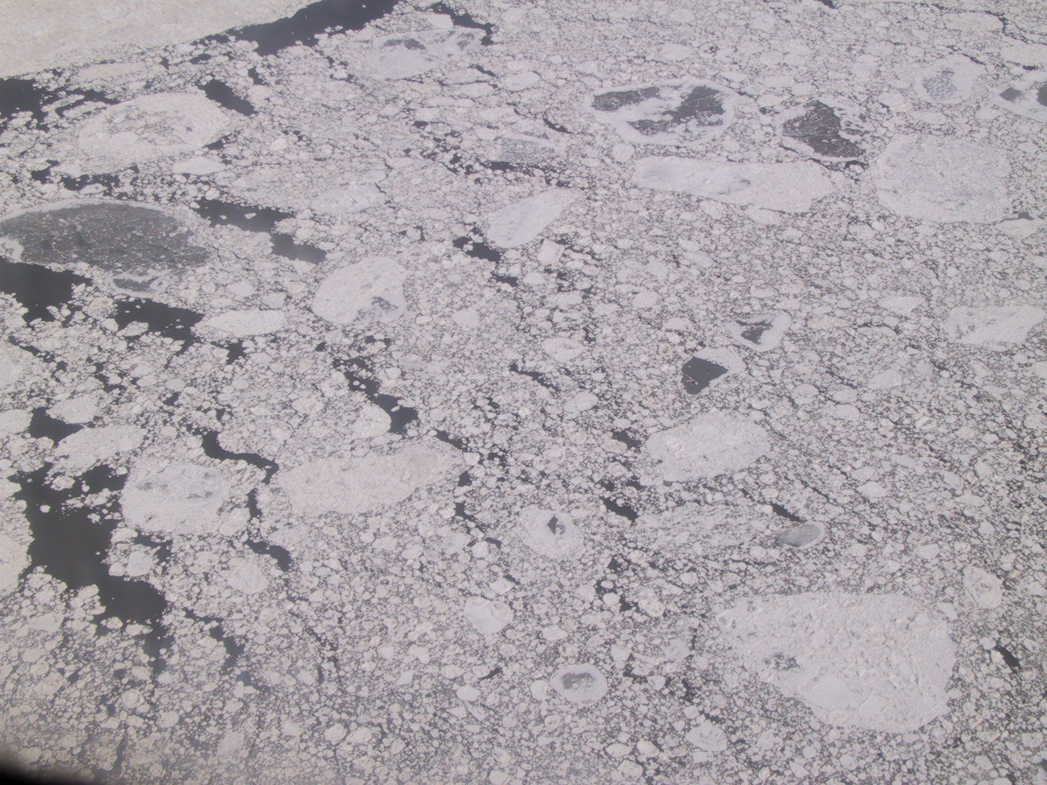
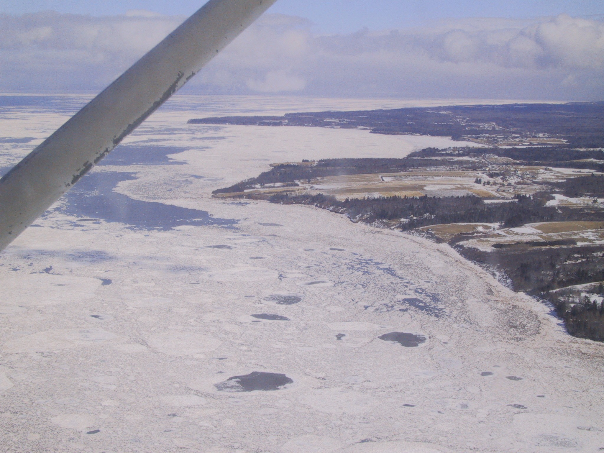
Figure 8. A variety of freely floating ice rafts in Minas Basin, March 1, 2007, as seen from a small aircraft.
By late March temperatures start to rise and the great melt begins. It may take up to two weeks for the big blocks to melt completely.
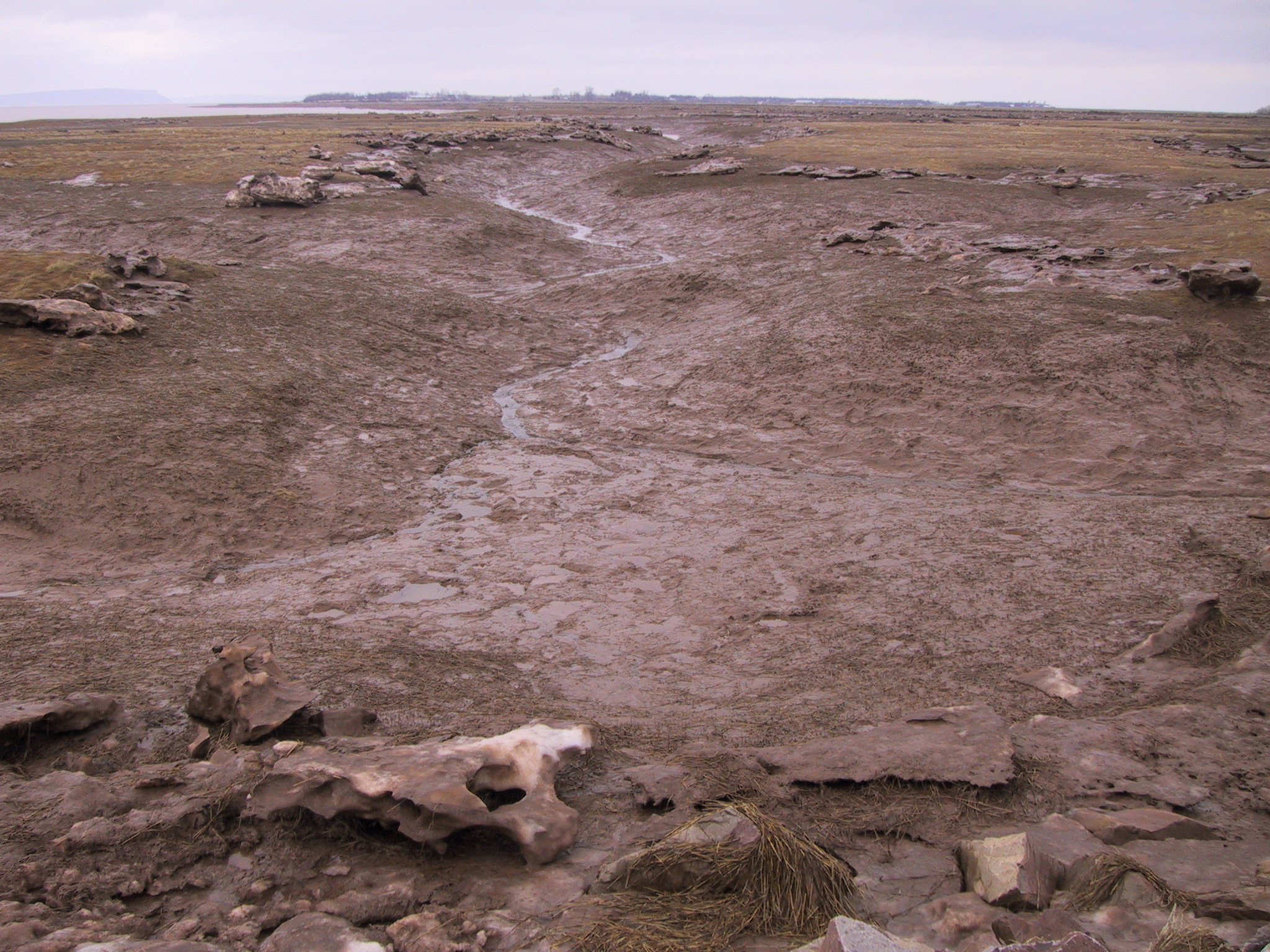

Figure 9. March 21, 2007. The average temperature had been above freezing for more than a week (see Figure 5). Left: Tidal channels with (slowly) melting ice blocks all situated on the channel edges. Right: what remained of one ice block: mud
So here is the interesting question: how much do the typical winter ice conditions contribute to the sediment budget so that the marsh can maintain elevation at Mean High Water level? To what extent owe tidal creeks their stability to their banks being frozen solid for 2 months?
Are these questions relevant? Yes, they are: tidal power generation is coming our way (see my earlier post on Nova Scotia tidal power development here) and without better numbers, modeling the effects of large-scale tidal power on the estuary remains guesswork. Ice is a concern for tidal power generation because of the possibility that heavy sediment-laden ice rafts may become detached from the marsh, barrel through the water below the surface and become cannonballs for tidal turbines. The Nova Scotia government commissioned a study on winter ice conditions about 10 years ago (Saunders and Baddour, 2006) but luck had it that 2005-6 was a winter without any ice, so these authors had to rely on literature.
A lot of excellent research on sediment budgets and marsh dynamics is carried out, notably by Dr. Paul Hill, Dr. Danika van Proosdij, and Dr. Brent Law, but winter ice is difficult to research because unpredictable and while they both acknowledge the importance, they haven’t been able to turn their attention to it yet as much as they would like.
Stay tuned.
February 10: My local paper retold a favourite ice raft Valentine’s Day folklore tale this week. Read it here
References
Desplanques, C. and D.J. Mossman, 2004, Tides and their seminal impact on the geology, geography, history, and socio-economics of the Bay of Fundy, eastern Canada. Atlantic Geology, v. 40, p. 1-130
Kosters, E.C., 2007 (abstract), Tides, Sediment and Ice: wreaking havoc with in stream tidal power development in Minas Basin? Program and Abstracts, Atlantic Canada Coastal and Estuarine Science, Society Conference, Sydney, NS.
van Proosdij, D., Milligan, T., Bugden, G. and C. Butler, 2009, A tale of two macrotidal estuaries: different morphodynamic response of the intertidal zone to causeway construction. Journal of Coastal Research, SI 56, 772-773. ISBN 0749-0258.
Sanders, R. and E. Baddour, 2006, Documenting Ice in the Bay of Fundy, Canada. National Research Council of Canada, Report no. CR 2006-01, 22 p + appendice


Pingback: Morsels For The Mind – 13/02/2015 › Six Incredible Things Before Breakfast
Loved reeading this thank you