UPDATED December 29, 2014
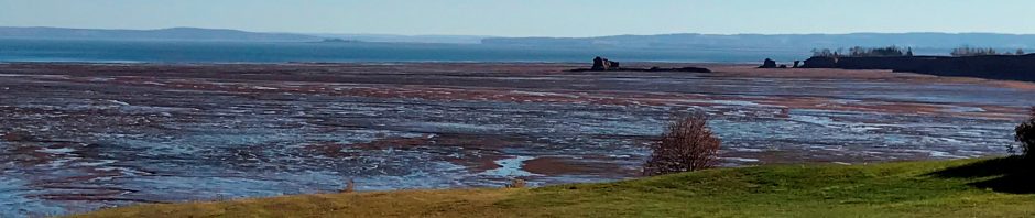
This was my blog’s banner photo until January 1, 2015. What are you looking at? In a world of Google Earth where everyone has a GPS in their cell phone, I should start with the coordinates. You are standing at 450 6’ N, 200 33’ W, and you are looking North.
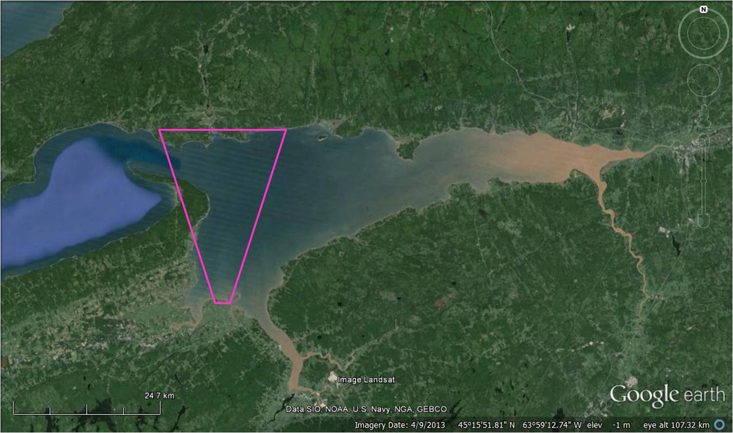
Minas Basin, Nova Scotia. The pink trapezoid indicates the view in the banner photo
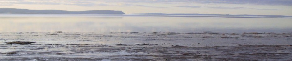
You are on the south shore of Minas Basin, which is the eastern arm of the Bay of Fundy, and this place has the world’s highest recorded tides: the average tide range (difference between mean high tide and mean low tide) is about 12 m, but it can increase to as much as 16 m.
The basin is about 80 km wide in an E-W direction and about 30 km at its largest N-S extent. It has a semi-diurnal tide (2 highs and 2 lows for each lunar day) and all that water comes in through the narrow Minas Passage. Actual tide charts are at http://tides.mobilegeographics.com/calendar/month/3799.html .
Minas Basin is surrounded by cliffs. The cliffs are exposed almost exclusively in soft sedimentary rocks, with the exception of the top of the Cape in the distance, which is exposed in Basalt. The cliffs therefore erode rapidly and new exposures are constant.
So this place is pretty much heaven for a sedimentologist. Which is what I am. I first became truly hooked on (clastic!) sedimentology while doing fieldwork for my Master’s thesis research in the macrotidal estuaries of the southwestern Netherlands, where the tide ranges is “only” about 4.5 m tide range.
This banner photo is pretty much the view from our house, which incorporates my office. I can’t think of living in a more interesting place, given that the people here are also really terrific.
Earth scientists categorize tide ranges as micro-(<2m), meso- (2-4m), macro (4-6m) or hypertidal (>6m). Minas Basin and only a handful of other estuaries in the world are a category of their own with their extreme tide ranges. The only estuary that bears any comparison to Minas Basin is Knik Arm in Alaska, which has a 10 m average tide range. Like Nova Scotia, that area was heavily glaciated during the Pleistocene and the glaciers left thick packages of sediments (tills, eskers, drumlines etc.). Also, Knik Arm is routinely covered in winter ice.
Another area of hypertides is is Ungava Bay in northern Quebec, which might actually have a marginally higher tide range than Minas Basin (difficult to measure), but there are no glacial deposits around Ungava Bay, because the area was scraped clean by the ice caps, leaving only bare rock exposed (easy to see on Google Earth). Famous for its extreme tides and tidal bore is the Bristol Channel / Severn estuary, separating South Wales from Dorset and Cornwall. Southern Wales was under ice caps during the maximum Pleistocene ice extent, but the ice didn’t reach across the Bristol Channel. The Gulf stream keeps this part of the world ice free year-round, even though it is at about 52deg N.
The extreme tide range of Minas Basin means that there is virtually no shipping. Too dangerous, the currents are as fast as Usain Bolt when he runs the 100 m dash. There are a couple dozen commercial fishing boats in this basin. Until a few years ago, especially designed vessels transported gypsum out of the basin, but the recession ended the demand for gyprock and the mine is now closed. In summer, we kayak here, though. We use a 2.5 hour time window just before high tide. It makes for interesting adventures.
Few people live here, but the interventions over the centuries have been more significant than you might imagine. About which more some other time.


It’s a lovely photograph. Thanks for all the perspectives you offer in this blog.It is a wonderful place with much to offer, environmentally & socially.
Thanks, Marke,
Tide ranges are generally classified as follows: microtidal (less than 2 m), mesotidal (2-4 m), macrotidal (4-6 m) and hypertidal (greater than 6 m). A couple of places on earth fall in the hypertidal category: the Severn estuary, parts of Brittany, Knik Arm (Alaska), Ungava Bay (Quebec), the Bay of Fundy, and parts of the Yellow Sea (between China and the Koreas). The largest tide range in the world is recorded in the upper Bay of Fundy, right here in Minas Basin. It gets up to nearly 20 m at Truro during Perigean Spring Tides. The only place that potentially competes with Minas Basin is hard-to-reach Ungava Bay. The difference between the tide ranges between Minas Basin and Ungava Bay is so minimal that it has never been established which one actually has the higher tide range. I believe this year (a Saros-tide year, hence even higher tides and therefore a better opportunity to measure) is where they hope to settle the score. Whatever the outcome, the highest tides of the world remain in Canada.
My blog is about earth science and society. I don’t want to focus on fishing or ship building because others are better qualified to cover those topics.